We’ve hiked the Jämtland Triangle (jämtlandstriangln in Swedish) twice, and have had a great experience both times. Although it is one of the most popular hikes, it doesn’t feel crowded on the trail, although in some of the mountain huts it can be.
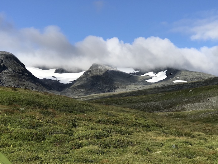
The hike is popular for a reason, as it has the right balance between being challenging and do-able, and the scenery is simply stunning. You are up in the mountains with peaks nearby and in the distance, with freshwater streams running nearby, with nice camping places and mountain huts if you need to have a meal or place to stay at each of the night stops.
Stages
Storulvån to Sylarna
Distance: 16km
This is the first stage, and it can be considered the hardest. I have found it to be the hardest, even though it is not the longest. The reason is that you are hiking uphill for large parts of the day, and in some parts you are walking on those rounded river stones that can be quite tiring.
As you walk you will cross a footbridge that is quite fun to cross and take a snack break, and then another stop with a hut where you can take lunch, and even rest your feet in a nearby stream.
After this, you should start seeing Sylarna in the distance – an imposing, beautiful sight. The STF mountain hut at the overnight stop has stunning views. If you want to you can stay in the accommodation overnight, or camp nearby.
On our first hike here, we actually did stop and camp here as the wet weather set in. We camped next to the river. It is a really nice spot, but not ideal if you want to hike the whole trail in three days.
Sylarna to Blåhammaren
Distance: 19 km
The second day is a longer hike in distance. After having breakfast and breaking camp you begin a long slow climb up to Blåhammaren, which is right near the border with Norway, with nice scenery all around it.
Blåhammaren to Storulvån
This third part of the hike is most downhill from Blåhammaren down to Storulvån, and is the easiest of all the days. Stop for lunch, or at least a break at the river crossing. The trail makes its way downhill, back into a birch forest and then back to the starting point. Stop at the STF for a snack or ice cream, rest your legs and shoulders for a while before heading off.
Distance: 12 km
How to Get to Storulvån and The Jämtland Triangle
There is a bus transfer that is run by Wänseth Buss from Duved, and it connects with the night train. Transfer to/from the night train can be booked by calling +46 647-704 77, or at the station, although in the busy summer periods it is better to call ahead to make sure there is room on the bus.
The other option is to drive. There is some parking at Storulvån, or on the road leading up to the mountain station.
Camping
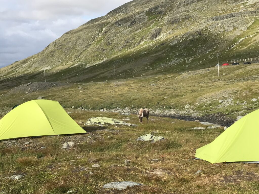
There are nice camping spots along the trail, but ideally you would want to stop for the night near to the STF mountain stations that mark the end of each day – although there is not requirement to do that. At Sylarna, it is a good 30 minutes walk off the main trail to the STF hut, so you could avoid that hike by camping closer to the main trail… but the views of Stora Sylarna are stunning, and you would miss out on that if you didn’t walk the extra distance. There is camping near to STF hut and across the small valley as well.
At Blåhammaren, you camp close to the STF mountain station, and the views are worth camping there and spending the time walking around and taking it in.
More information on the STF website here: https://www.svenskaturistforeningen.se/guider-tips/leder/jamtlandstriangeln/